Paul Deakin

Northampton Market and Forty Years Trading There
Francis Frith's Northamptonshire Living Memories
Northampton Market and Forty Years Trading There
Fred Golby. 2006. Printed by Warwick Printing Co Ltd., Caswell Road, Leamington Spa CV31 1QD. [60 pages including 83 B&W prints and photographs.]
“I shall always remember as a small boy in the late 1920s when my father took me to Northampton market on a Saturday evening. The market and the surrounding shops stayed open until 9 o'clock and the whole area was still very busy. This was before the meat and fish market was built, and housewives were queuing up to buy butchers' meat which was sold off cheaply at the end of the day. The lights on the stalls consisted of a gas jet…. Little did I know that I would set up my own stall on the market and our family would trade there for forty years.” Thus begins Duston historian Fred Golby’s history of Northampton Market and his account of his own family’s trading there.
The market has a long history, dating back to 1285 when its royal charter was granted - before this date trading took place in the churchyard of All Saints Church. It was the site for one of the greatest trading and hiring fairs in mediaeval times, and was used for cattle trading until 1873. It was the place where punishment was dealt out for petty crimes at the pillory in the south east corner of the square. During the great Northampton fire of 1675 huge quantities of household belongings were stacked in the market to keep them safe from the flames. During the last war, tunnels under the square, originally used for storing wine and spirits, were opened and used as air-raid shelters. And it has been the scene of many great celebrations and ceremonial occasions, including jubilee proclamations and the VE day celebrations of 1945.

In Fred's book we hear of the country people who used to flock to the market from outlying villages in the years after the War, coming in from Castle Station and the bus station (then at Derngate), the old fountain demolished in 1962, gas-lit stalls, the buildings around the square (including the Emporium Arcade and the old premises of Chronicle & Echo) and the characters who participated in the colourful life of the market.

The Appendix contains extracts from historical works describing the markets, fairs, market cross, beadles and town-crier.
The book is packed with many fascinating pictures and photographs of the market and surrounding streets from the nineteenth century onwards.

Fred has witnessed many changes in market life but interestingly observes that “things go full circle, and in recent years there has been a trend towards farmers’ markets where people are enthusiastic to go and buy local produce from the farmers and growers, just as they used to buy from me and my family”.
This is a unique record of the market, adding new insights to Northampton’s history. The atmosphere of the market over the years is beautifully invoked in both words and pictures. The book is available from Golby’s Garden Centre, and local bookshops and libraries. For an extract, see Christmas Scene at Northampton Market in the Sixties.
Francis Frith's Northamptonshire Living Memories
Martin Andrew. 2002. Frith Book Company Ltd. [ISBN 1-85937-529-4. 128 pages including 150 B&W photographs. £14.99. Hardback.]
The photographs in this book are of Northamptonshire towns and villages mostly in the 1950s: the era before shopping precincts, motorways and out-of-town development. Author Martin Andrew neatly sums up the period as 'a curious twilight decade. The country still had lingering wartime rationing, austerity, drabness and relative stagnation in the early part of the decade, while by the end, the words of Prime Minister Harold Macmillan, "You've never had it so good", echoed in its ears'.

Looking at the pictures of Northampton town centre, the changes in the fabric of the town since that era are obvious. From the photo of the Market Place c1950 we can see that all the buildings on the northern edge of the square have since been demolished, having been replaced by the Grosvenor Centre in the 1970s. Also, the elaborate fountain in the centre of the square that commemorated the wedding of Prince Edward, later Edward VII, in 1863 was demolished in 1962. There is a view of Abington Street c1955 before pedestrianisation, with double-decker buses approaching and the Fifty Shilling Tailors shop in the foreground.

But looking at the many pictures of Northamptonshire villages, including Duston, the changes are not so obvious. Many of the cottages in the village centres still remain today. The proliferation of new estates on the outskirts of the villages is probably the most significant change. Also, as Mr Andrew comments in the book's introduction, there has been a change in the type of inhabitants, not obvious from looking at the photographs: 'The villages were boosted by the managerial classes and white collar workers who took on decaying houses and cottages by the score in villages ringing the towns. [But most Northamptonshire] villages retain a greater social mix of countrymen and townsmen than in the equally attractive Cotswold villages: and even more markedly so in the 1950s and 1960s'.

The book includes four pictures of Duston with three views of Main Road in the old village (two c1955 and one c1960) and a view of the British Timken offices c1955. The village in those days presented a charming rural scene, with a mixture of 17th- and 18th-century stone-built cottages, The Squirrels (with thatched roof), and the Congregational Chapel, now replaced by the United Reformed Church. Also there is hardly any traffic in the village centre; the few vehicles are of Austin or Morris types, apart from one Ford Anglia, which is almost futuristic looking by contrast. The inclusion of British Timken seems almost pointless, since it looks exactly the same today as in 1955. However, with its recent closure, the book will be a future reminder of a time when a major engineering works existed in the area.
For more historical photographs it is also worth looking at the Francis Frith Collection website. Here you can search for British cities, towns and villages from some 49,000 images, which can be ordered as framed or mounted prints online.
Below is some more information about the locations described on the DFG map described in Historical Tour of St James End.
|
a |
St James Mill (Duston Lower Mill) SP749592. Early monastic mill, belonging to St James Abbey on the north side of the millstream, straddling the millbrook. Today at river end of Millbrook Close, adjacent to public footpath to River Nene. No building visible. Ceased post-1945. |
|
|
|
|
b |
The Green Man. SP743606 On the corner of St James Road and St James Mill Road. Tollhouse 1739 to 1764. Still a public house, renamed Thomas A Becket. |
|
|
|
|
c |
St James Square. Major road junction of Banbury Lane and Moor Lane (1730), now of Weedon Road (A4500, previously A45) and Harlestone Road (A428). SP741607. Position of Turnpike (1765), southwest corner of Square (demolished for road widening), was position of Tollhouse. Pictured in works of Fred Golby (A History of Old Duston and Old St James [p.102] and Duston and St James [p.77]). From this corner, Abbey Street commences. To the west, on the south side, is St James Working Men’s Club just inside Weedon Road. |
|
|
|
|
(m) |
This was the position of St Margaret’s Church – annexed to the Vicarage of (St Luke’s) Duston about AD 1259. (See “m” on map), SP740607. |
|
|
|
|
d |
The Rover Public House (previously Red Rover, The Red House) SP746608. Not illustrated on the map. To the west, in Malcolm Drive, the Millbrook entrance to the Abbey Mill is still visible. SP745608. To the east, the conduit still exists underground. Nothing visible. |
|
|
|
|
e |
St James Abbey Church. SP734607 to SP735606 approx. Part of Abbey Site 1173 to 1546, demolished post-1546. Abbey Works 1909. Express Lifts 1917 to 1999. Now demolished and replaced by blocks of flats. Nothing visible. |
|
|
|
|
g |
St James Abbey Farm and Water Mill. SP737604 approx. |
|
|
|
|
(h) |
Constructed on the south side of the east/west Roman Road. The Abbey being on the north side. Now part of the Saints Rugby Football Ground, only visible remains are the millbrook flowing out of the Saints ground and across their training area. Traversed by public footpath Abbey Street to Sixfields (SP740607 to SP727600), (“h” on map). Previously medieval road to Kislingbury. |
|
|
|
|
j |
St James Spring. Start of the main millbrook to St James Abbey Mill. SP730609. Now much reduced in flow but still runs. In private house garden, rear of Duston Road. Not accessible. Off map – Duston Upper Mill. SP729596. Dallington Mill. 743610. |
|
|
|
|
m |
St Margaret’s Church (see c), was 'Little Bully Acre – Free' in 1730. Now under St James Working Men’s Club or thereabouts. |
|
|
|
|
n |
The Conduit. At the head of the 'the Conduit' was a wellhead in the stable block of the only property in this position in 1886, SP734612. It is stated to feed a stone pipe with shaped cover running to the Abbey latrines. s to n is the north/south line of projected Roman road, which may have passed this spot. From Dr J Williams’ dig site 1970’s maps. Now part of The Avenue, Dallington, the Victorian house still stands, but the stable block is demolished and replaced by modern housing. The wellhead is covered and forms a decoration in a private house garden. Not accessible. |
|
|
|
|
t |
Westbridge SP746603 t to w is the probable east/west Roman road line. The older bridges were east of the present modern bridges and probably north (if Roman) and south (if Saxon), (highly conjectural); Westbridge is also a small district of Northampton. |
|
w |
Further west of Duston village, Berrywood Road is generally accepted as the Old Roman Road to Bannaventa, but off this map. |
|
|
|
|
x |
Site of major road junction from antiquity. SP733608 Site of nine-acre Roman cemetery (discovered 1860 to 1871). Cherry Lane junction. Duston Road re-routed to this spot 1884. Turnpike re-routed from this point 1765. Still major road junction of Peverel Way, Ross Road, Weedon Road, Cherry Lane and Duston Road. Roman town under old part of Ross Road Industrial Estate on embankment cemetery under Homebase car parks and industrial estate. Part of town under community tip as far as modern gymnasium (Weedon Road, down to Walter Tull Way). Nothing visible today, apart from southeast corner of embankment, used as iron stone railway yards 1855 to 1909. |
Related Topics
Taking Bearings
St James End incorporates the area from St James Mill Road, out to the area around St James Square to the west. 'St James' is the whole area from Westbridge, stretching westwards to some unspecified boundary, probably Bants Lane, when it turns into 'Duston'. In reality, St James is just an area of the original manor of Duston and takes its name from the Abbey of St James, founded 12th century, dissolved 16th century.
The Saints Rugby Football Club takes its name from St James Church, built 1868 on the east side of St James Square, where the Club started. By chance, the Abbey site was shaped like a 40 acre rugby football, which is appropriate since their HQ occupies part of the old Abbey site.
The Avenue, Dallington is really part of St James or Duston, as it was originally, and is a separate private estate accessed only from Harlestone Road, opposite Dallington Park. Thus it is said to be in Dallington is for convenience.
Westbridge is the area of town surrounding the railway bridge (at Northampton station), stretching out to St James Mill Road. The present bridge was constructed when the railway was built in the 19th century. The northern arm of the River Nene moved westwards at that time to accommodate the railway. Earlier bridges were therefore further east and below the castle headland. The railway line and car parks sit in the old riverbed.
DFG Map
 The map shown here was produced by DFG Publishing in 1990 ('DFG map') and is but a part of a much larger document that covered the whole of Duston manor as it was, from the end of the Civil War up to 1730. Positions on the map are denoted by letters shown in red.
St James Mill
Starting at the bottom left, we have St James Mill at a, this was served by the Millbrook originally, but more water was needed, so a millstream was diverted from the River Nene. Millstreams served both Duston Upper Mill (off map) and this mill. The Abbey Mill and Dallington Mill in the adjacent parish appear to have functioned on the water from St James Spring and Dallington Brook quite adequately.
St James Mill was a double header (twin pairs of millstones) and run by the monks of St James Abbey until the dissolution of their monastery in 1546. Had they held out for a couple more years, the Abbey might have survived. The Mill continued in use until 1939/1945. Today, with water extraction, drainage schemes and underground pipework, it is difficult to imagine the amount of water that must have flowed in antiquity – but the channels still exist to be seen. St James Mill site is at the bottom of a footpath, close to Millbrook Close, down St James Mill Road. The mill streams and the mill brook can still be seen there.

Thomas A Becket Public House
 Back to our map - we travel up St James Mill Road to the junction with St James Road; at b is the Thomas A Becket Public House. It was then The Green Man. In 1739 the Green Man became the tollhouse for the 1738/9 turnpike (toll road), called Moor Lane on the map, but today Harlestone Road (A428). Later The Green Man would host the discussions in 1777 concerning Duston Enclosure Awards.
The Thomas A Becket is at 52 St James' Road; across St James' Mill road was the Harborough Arms, at 46. Over St James' road, at 27, stood the Robin Hood Inn. These last two were demolished for road widening.
Roads Through St James
b to c is St James Road and c would become St James Square as it is today, then the junction of Moor Lane and Banbury Lane, today Harlestone Road and Weedon Road. As you can see, the main road system was quite different in 1730. g to h was the main road to the south of the Abbey, on to Upton and Kislingbury, while c, d, x up towards w, was the main road to Daventry, via Duston village and Berrywood Road, the old Roman Road. Finally, the main road to Rugby was Moor Lane c, then off the map, up Port Road, Duston the Portweye – through Althorp and Brington – until 1738/9, when the turnpike, mentioned above, ran further north as it is today (A428).
 In 1765, all this changed. A new turnpike was opened from St James Square, which thus had two, the 1738/9 Harlestone Road one and the new one to Weedon, replacing Banbury Lane and Duston with a brand new road, avoiding all villages to Flore and Weedon. A Turnpike was set up right across St James Square, serving both roads and The Green Man ceased to be the Tollbooth. A new Tollhouse was constructed on the south side of St James Square and the old Main Road dwindled to become Abbey Street and the footpath to Sixfields, as it is today. Opposite, we find m, just off St James Square. This was the site of St Margaret’s Church, self contained, but part of the Abbey site and contiguous to the west side of the Toll House – which was just across the road (h, g, c) or Abbey Street today. In 1730, it was Little Bully Acres – free. f was Great Meadow, i was Inn Meadow, perhaps belonging to The Green Man, while k was Long Hollows.
St James Abbey
Continuing our walk, we come to a public house at d, opposite the Abbey gates. Today, the Abbey, opened in 1173 on land donated by William Peverel in 1104, is long gone. A 40-acre site, it lasted until 1546 when the Giffords acquired it and demolished the property for building materials. Had it survived a couple more years, we might be telling a different story.
 In 1909, Abbey Works was built here, becoming the Express Lift Company in 1917. Abbey Works was built on the site of the Abbey Church, which was recently excavated and found to be 80 metres long. Behind it and under the factory were the cloisters, cemetery and further back the farm and water mill. The Abbey Church is at e on this map and the whole site was surrounded by a high stone wall. Today a block of flats stands in front of the Abbey building position and gives an impression of what it might have looked like.
 The monks used their mills for several purposes and had mills elsewhere, such as Billing. The Augustinian Monks, Blackfriars, were great cloth makers, fullers and dyers on their own site, around position g, they had a small mill, part of their farm site, south of the Roman Road (w to t), their religious buildings being built on the northern side.
 To serve their mill, water was brought down from St James Spring (j) and under the Weedon Road to the west of the Rover Public House. To the east of the hostelry, they brought spring water from point d, down a stone conduit to their cloisters and latrines. The map fails to recognise this because the conduit was a sculpted underground pipe, not visible. Today the mill brook entrance can still be found (in Malcolm Drive), and also the wellhead to the conduit. The mill brook exit can be seen along the footpath – the old medieval Main Road – from Abbey Street to Sixfields.
Roman Town & Cemetery
 Finally, Field 66 may have been the initial Roman settlement with Fields 49, 50 and 82 the later Roman Town (now Ross Road Industrial Estate). s to n is the projected and estimated Roman Road (north/south), and w to t, the Roman Road (east/west).
These fields became an ironstone railway terminus in 1854/5. While the ironstone railway could run from s/east to s/west in a straight line, the impression is given that a feature must have existed in antiquity of embankments, probably ditches and earthworks from the Roman period. This is supported during the archaeological digs of the 1970s, when Dr J Williams found an unexplained and large ditch running across his main site, at the appropriate position.
 Further evidence of a Roman settlement came from the Roman cemetery at position x,later quarried (1860 and 1871) and now the site of Homebase.
See Also
DFG Map Notes for more information about the locations described on this page.
References
DFG Map © 1990 DFG Publishing, based on a compilation of a map of Duston Mannor (sic) from the 1660s drawn by the Right Honourable Thomas Cook Esq., Vice Chamberlain of His Majesty’s Household, and another drawn by C. Price 1722 Vera Copia P.H. Walker 1730. Article written by Dave Blackburn.
Related Topics
William Peveril founded an Abbey for the order of St. Augustine on the Weedon Road at the beginning of the twelfth century in the reign of Henry I.
He endowed it with 40 acres in Duston, the church in Duston and Duston Mill. The Abbey stood for some 400 years and, during that long period, 23 abbots and canons with some 30 rectories in the area appropriated to the Abbey.
Nicholas de Flore was confirmed abbot on 19th March 1298 in the reign of Edward I, and remained so until 1334. The tomb cover of Nicholas de Flore was placed in St. Luke's Church, Duston after the dissolution of the monasteries in the 16th century, and has remained there ever since.
Related Topics
A list of vicars is inscribed on the wooden board on the south wall of St Luke's Church. The list here gives information in addition to that shown on the board. It was collated by the late Ray Lagden, Duston historian, with added provenance and a few observations by the St Luke’s Churchyard Research Group.
- Walter de Alto by composition with Ralph, abbot of St James between 1158 and 1176, was permitted to hold the Church of Duston as long as he continued as a secular priest, on condition of paying 5d. yearly for services at the alter of St James abbey.
- William de Northampton
- Warine, chaplain, presented by the abbot and convent of St James, at the time of the ordination of the vicarage, 1227.
- Warner, chaplain, July 1232.
- Giles de Brunham, presented to the vicarage of Duston, with the chapel of the blessed Margaret annexed, 1259.
- William de Ken, chaplain 1260
- Richard de Welton, priest, 9th March, 1274-5.
- Robert de Blockele, deacon, 8th July 1274. He resigned the following month, and obtained the vicarage of Bozeate.
- Albred de Bondon, priest, 26th July 1274. He resigned for the vicarage of Spratton, another of the abbey benefices.
- Walter de Desebur, priest, 9th February, 1278-9.
- John Baret of Isham, chaplain, 31st January, 1310-1311.
- William le Clerk
- Geoffrey Capes of Gt. Preston, priest, 10th January, 1349-1350.
- Robert le Gray of Bosgate, priest, 28th November, 1365.
- William Assheby, priest, 8th June, 1380.
- William Rode. (St Luke’s Church reached its present size.)
- Edmund Cook, priest, 15th March, 1437. He resigned the following year for the vicarage of Rothersthorpe.
- John Cristyan, priest, 16th March, 1438-9.
- Richard Frankysh, priest, 19th December, 1444. He resigned in1449 for the vicarage of Bozeate. (Duston was part of the Diocese of Lincoln originally.)
- John Keppyng, priest, 7th October, 1449, by the Bishop of Lincoln.
- Sir Robert Shipley, priest,by the abbot and convent of St James, 28th October, 1497.
- Sir John Wyzate, priest, 9th June 1503.
- Sir Thomas Copull, prior of Caldwell, 22nd March 1506.
- Sir James Robert, 9th October, 1510. By will dated December 1532, Sir James”Roberd,” priest, bequeathed his body to be buried in the churchyard of our blessed lady in Duston ”nye unto the crosse,” to the abbot of St James 2s.; to every canon there, being a priest, 12d.; to every novice there 12d., and recites that Lord John Dossett, abbot of St James, owed him £10 5s 0d. and also 13s 4d. for a horse.
- Sir Robert Parke, chaplain, 6th October, 1515. By his will dated 25th June, 1519, he desired his body to be buried before our lady in the body of the church within the abbey of St James’, and bequeathed to the lord abbot for his second mortuary, a cow, or else a gown; and a penny dole through the town of Duston on the day of his burial.
- Sir Nicholas Taylor, 1st July, 1519, who occurs in the ecclesiastical survey of 1535 as “Nich. Tailo.”
- Sir Thomas Atherbery, chaplain, by George Gifford, by grant from the abbot and convent of St James, 1539. (The Giffords [or Giffards] obtained the abbey post dissolution)
- Hugh Paladie, 1552, on whose deprivation.
- Edmund Townshend was collated by the bishop of Peterborough by lapse and instituted 16th October, 1554. He was also the rector of Yardley Hastings. (note change to Peterborough diocese.)
- William Yens (or James), was instituted 10th March 1560-1, on the presentation of Thomas Hunt, and Alice his wife.
- Antony Reynolds, buried here 15th November, 1616.
- Edward Warren was instituted 20th November, 1616, on the presentation of the Rev. Robert Catelin (rector of Wootton). “He was buried here 16th January, 1617,” and
- Edmund James was presented by Sir Ralph Rich (afterwards 2nd Earl of Warwick) and instituted 27th March, 1617, on whose decease
- James Lewis, A.M., was instituted 8th November, 1642, on the presentation of Daniel Reading, gent.
- ------- Coales, 1659, on whose cession,
- Edward Pierce, A.M., was presented by Mary Reading, and instituted 3rd December, 1662. He was afterwards rector of Cottesbrook. On his resignation
- John Russell, A.M., was presented by Mary Reading, of Northampton, widow, and instituted 21st October, 1663. The two succeeding incumbents also held the vicarage of Dallington:
- John Woodford, A.M., of Brasenose College, Oxford, instituted 19th December, 1678, and buried here 9th June, 1706 and
- Thomas Danser, A.B., of Queen’s College, Cambridge, instituted 11th October, 1706, on the presentation of Thomas Coke, Esq., (vice chamberlain of His Majesty’s household per estate map 1722,) and buried here 30th October, 1738. His successor
- Thomas Grieve, A.B., was instituted 19th Manch, 1738-9, on the presentation of George Lewis Coke, Esq., and buried here 6th January, 1745-6,when
- George Beet, A.B., was presented by the same patron, and instituted 20th June, 1746. He was also vicar of Naseby, but resided at Harpole, where he was curate for many years, and died 4th May, 1768. He was succeeded by
- John Clarke, A.M., rector of Collingtree, who was presented by Sir Matthew Lamb and instituted 14th July, 1768. He resigned Collingtree in 1778, but held the vicarage of Weston Underwood, in Buckinghamshire, with this benefice, and was master of the free grammar school at Guilsborough, where he resided and died 1st March 1811, at the advanced age of 87 years. He published “Christ’s nativity, the good tidings of great joy to all people,” a sermon preached at Collingtree, 1762 .(during his time, work was carried out on the south side of St Luke’s.)
- Joshua Greville, A.M., of Trinity college, Cambridge, was instituted 19th July, 1811, on the presentation of Peniston, Viscount Melbourne. (For whom the 1840 vicarage was built.)
- Robert Henry Cox, B.A., 1851. (iron ore found on Church land, first restoration 1854.)
- Peake Banton, 1863, by whom the stained glass in the west window was given (founder member of Northampton Central Museum, major church restoration period).
- Conrad Rbt. Barker, M.A., 1891.
- William Cockin Richardson, M.A., 1897, afterwards Rector of Benefield, Northants (retired to Sunningdale, Berkshire, responsible for the new lychgate and for removing the exterior plaster from some church walls.)
- F.B.A. Williams, M.A., 1907, afterwards Vicar of St Matthews, Leicester, and Rector of Wymondham, Leicestershire. (Died August, 1932).
- William Dewhurst Pearson, M.A., 1913, who died at Duston Vicarage, December 1926.
- A.E. Averay Jones, M.A., instituted 5th May, 1927, by Dr. Claude Blagden, Bishop of Peterborough.
- L.A. Thompson L. Th. 1935
- John H. Butcher 1943
- James W. Royan L.Th. 1953 Bes L. F.S.A. Scot.
- Eric Buchanan B.A. 1964. (major church work, removal of pews, stonework restoration, drainage improvements, churchyard restored).
- Peter Garlick, A.K.C. 1979 (restoration continued).
- Dr. Nigel Dent 1996
- Neil Purvey-Tyrer 2002 - 2007
- Alan Baines 2005
Acknowledgments
Ray Lagden gratefully acknowledged the help derived from the following books in the Local Room of the Northampton Public Library.- Architectural Notes, 1890-1892. Edited by D. Reynolds and E. Bradbury.
- Baker: History of the County of Northampton.
- Whellan’s Northampton.
- North: The Church Bells of Northamptonshire.
- Bridges: History of Northampton.
See Also
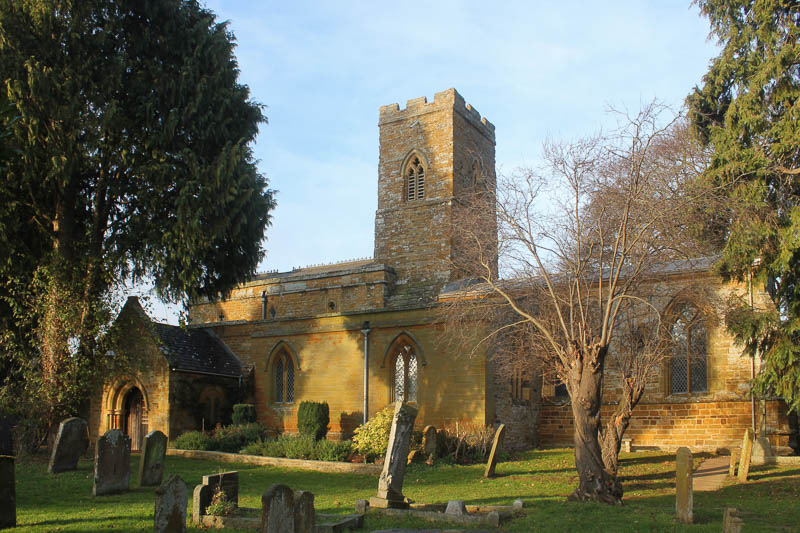
Tour of St Luke's Church.Survey of Memorials at St Luke's Church
At the end of the west wall of St Luke’s Church is a hole about 5'6" above the ground. The conventional explanation is that it is a leper’s squint, built to enable lepers and others forbidden from entering the church to view services. In this article, local historian Dave Blackburn argues for an alternative explanation – that there was an anchorite cell against the wall of the church.
 In the Middle Ages small cells were sometimes built against the walls of churches, usually on the north side, in which the recluse could live – these were known asanchorite cells. There would be an internal squint, or hagioscope, for viewing an altar, and an external hole through which food would be given by benefactors. I have examined two such external holes, one at St. Luke’s and one at Thurne in Norfolk. There are common features. Each is positioned at the west end; each is directed towards a religious building in the distance - the Abbey near Thurne and the Old Vicarage at Duston. Both are specially mounted at the outer end by a carved oolithic limestone orifice of similar dimensions with a circular hole of about 6” (15 cms) diameter. Each is worn externally. The inner is missing at St. Luke’s, but the similar orifice internally at Thurne is not worn.
Each church dates from a similar period: 12th to 14th C. (St. Luke’s); 13th to 15th C (Thurne). Each was connected to a monastery.
 In the case of Thurne, the church is original, the inner cell being in the tower. There are no side aisles. St. Luke’s has a north aisle, in which such a cell could have been set. The side aisles at St. Luke’s are known to have contained altars and to have been dedicated as side chapels, prior to the Victorian restorations.
In both cases, the interpretation has been ‘lepers squint’ for the external orifice. Mark Child in Discovering Church Architecture (Shire Publications 2004), states that ‘lepers squints’ were ‘so named from the belief that lepers, who could not enter the church, used to see the mass in progress. The position of most such windows proves this to be untrue’. To this I would add a rider – at this time the mass tended to be an act of some secrecy with rood screens and officials tending to obscure the proceedings from the congregation.
There remains the suggestion of signalling. Each access hole is about, or would have been about, 4’0” (1m 20cms) deep, square in section with a flat floor and capped both ends by a limestone end piece, with the circular hole described. In case of difficulty, e.g. illness, hunger or danger to the anchorite or the church, a light could have been seen only from a very specific point directly opposite. In the case of Thurne, this would have been at the abbey gates some 1½ miles away; in the case of Duston, it would have been at the old vicarage about 50 yards away. Given the very similar construction in both cases, an anchorite cell appears to be the most plausible explanation, particularly taking into account the external wear pattern, suggesting food being pushed through the orifice over a long period.
Acknowledgments
My thanks to the producer of Riddles of the River with Bryan McNerney, Anglia Television, Northampton Central Library, the Parish of Thurne, Norfolk and the staff of Exeter Cathedral for their kind assistance in this investigation. D.B.Related Topics
Tour of St Luke's ChurchThe tomb cover of Nicholas de Flore is in the vestry of St Luke's Church, Duston. Soon after the the Rev. Royan was appointed as the vicar of Duston in 1953, he noticed that the large slab on the stone floor of St Luke's Church was getting very damaged, and the lettering obliterated.

After cleaning the face of the stone, he found that all the lettering was in Latin. The slab stone had been there since the demolition of St. James Abbey in the sixteenth century, and had puzzled historians for centuries. Rev Royan thought that it must be of religious and historic interest, and so began a thorough cleaning of the monument, making an effort to decipher the lettering.
After hours of work, the vicar finally succeeded in deciphering the damaged Latin letters on the slab. It reads:
'HIC JACET IN PETRA SCULPTA DE MARMORE TETRA N. FLOS DE FLORE, GREGIS ISTIUS ACTUS HONORE. PASTOR SUBLATUS FRUIT HlC ET MORIGERATUS. SIT (CHRISTI) NATUS ANIMA (MQUE) DEUS MISER (ATUS)'
'Here lies in a dank coffin fashioned out of marble Nicholas the flower of Flore, shepherd of yonder flock now forced from his office. Exhausted was he and considerate. May he prove a son of Christ and may God have mercy on his soul.'
He then went to great lengths to discover its origin and significance. It was found that the monumental slab once covered the tomb of Abbot Nicholas de Flore who died on August 13th 1334. He ruled the Abbey for 36 years and was the twelfth Abbot. After the time of the dissolution of the Abbey by Henry VIII in the 16th century, the tomb cover was moved to St. Luke’s Church.
The tomb cover was originally mounted off the floor of St Luke's, in the old vestry (with glass partition, just visible in the photograph). It is now cemented in the floor of the vestry, sealed with matting. It is one of the few artefacts remaining of the huge St. James Abbey that stood for some 400 years, of which the Duston church was a part.
Many church members helped in the work of restoring the tomb cover, including J S S Allaway, John Bandy and Sid Mundy. Also, the British Timken apprentices, who made the intricate inlaid brass work.
Related Topics
Tour of St Luke's ChurchSt James Abbey
The shrine is within an arch on the perimeter walk in St Luke’s churchyard, and is dedicated to the late Father Nigel Dent.

The tile panel celebrates St. Francis, St. Clare and St. Luke; Father Nigel was a member of the Third Order of St. Francis, and St. Francis is our sister church. St. Francis lived from 1182 to 1226 AD, just about the time St. Luke’s church was in its heyday and part of the Abbey of St. James, so it was thought that a panel in the medieval style would be appropriate, full of allegorical meaning.
Key to the shrine

The Cross, empty, sign of the risen Christ, blood red, for His blood shed for us.
a. Celtic Sun face from Cornwall, overlaying the Cross. St. Francis bore signs of the crucifixion stigmata at his death.
b. & c. Daisy tiles. The day’s eye, opening and closing with the daylight. Our forebears saw in its yellow disc a miniature sun with rays.
There are also ‘moon daisies’. St. Clare was nicknamed ‘Sister Moon’.
d. Pax et Bonum. A tile brought from Assisi by our own Duston pilgrims. ‘Pax’, the peace of God which passes all understanding. ‘Bonum’, blessing and moral goodness.
e. Blue Tit. St. Francis loved the birds and the flowers. An industrious little bird that can have as many as twelve young, but only one will survive the year.
f. Cuckoo. A taker, gives very little and takes much. Can also have twelve young, one in each of twelve other birds’ nests. Others will raise its young - at the cost of their own.
g. Sun Tile. ‘Brother Sun’ again.
h. Moon Tile. ‘Sister Moon’ again.
i. Kingfisher. ‘The Halcyon’. Here representing water and the brilliant colours of summer warmth - the halcyon days.
j. Greek tile in blue, representing St. Luke. One soldier binding another’s wounds. This tile comes from Corfu. St. Luke was a Greek - ‘The Beloved Physician’ - and also Patron Saint of artists. St. Francis spent a year’s confinement and suffered a serious illness as a prisoner of war.
The background tiles are sky blue, indicating the sky and infinity.
Life of St Francis
St. Francis was born in Assisi - Francis Bernardone - of a wealthy family. After enjoying the trappings and lifestyle of a wealthy man, he was confined for a year as a prisoner of war and suffered a serious illness.Following these experiences, he was converted to a caring way of life. He sold all his property to give to the church and began to care for the poor. Eventually disinherited by his family, this saintly man began to attract followers. He founded the Franciscan Order (Friars Minor, Friarites, Grey friars). Soon he attracted support from the Pope.
Knowing the pitfalls, he laid down tough rules for his Order to prevent the corruption of wealth. St. Clare (1194 to 1253 AD) joined him when she was 18, and St. Francis founded a separate order of Franciscan nuns or 'Poor Clares'. St. Francis is remembered as the most blameless and gentle of all the saints, the most Christlike figure of the Middle Ages.
A series of illustrations 'The Little Flowers of St. Francis' illustrate the simplicity, the happiness and poetry of 'the little poor man', who preached to the birds and loved nature.
Acknowledgements
St. Luke's Churchyard Team extend grateful thanks to Discount Ceramics Ltd, Saddleback Road; The Tile House Ltd., St. James Mill Road; and Mark White, for supplies, support and technical advice during this project.In the chancel of St. Luke's Church, Duston there is a unique collection of painted figures depicting old church musicians of long ago. They are chancel corbels (stone brackets set in the corner between wall and roof) and research tells us that they have been there since the chancel was erected in the fourteenth century. There are four corbels at St Luke’s:
- Man seated on the ground playing a harp.
- Man beating a pair of kettledrums.
- Woman issuing from the church and playing the bagpipes.
- Fiddler.
The numbers of musicians playing in village churches varied, but we can get some idea of the music played at St Luke’s from the record books of two hundred years ago. Here are some of the items related to expenditure on music in the late eighteenth century:
- 1788. Payment for six cases (these would be viol cases).
- 1808. Eight shillings for a tune book.
- 1809. Money paid to the singing master (choir master) for a large quantity of candles for singing practice.
- 1810 - 1852. There could have been quite an orchestra here during this period, judging from the expenditure on musical items - for instance: a bass and bow (four pounds and ten shillings); a bag for a viol; money for binding five tune books; two strings for a bass viol.
Thomas Hardy's book Under the Greenwood Treedescribes the musicians struggling round the villages with their instruments on a bitter Christmas night, so cold that the keys of the clarinets and the strings of the viols froze in the icy wind. Boys carried the candle lanterns and held up the music for them, and they would all arrive home at about 2am from visits to outlying farms.
When Duston church underwent a major restoration in 1866, a harmonium was purchased by-Reverend Banton, and his family placed the lovely brass lectern in the chancel. The chancel was completely restored by Earl Cowper, who inherited the estate from Lady Palmerstone, and oak choir pews were installed, together with new altar rails, and the floor was re-laid with Minton tiles.
Fred Golby
See Also
For more about the history of Duston, see Fred's bookA History of Old Duston & Old St James.For more about the history of St Luke's, see Tour of St Luke's Church.